
CAV Resources / Travel Guide
Ultimate 2026 Colorado Summer Road Trip
The Ultimate Colorado Family Road Trip: An Epic Loop from Golden
May 25th, 2026
By: Bobby Wild
Some road trips are planned down to the minute. This one isn't. This is the kind of trip where you give the kids a window seat and a bag of snacks, point the car toward the mountains, and let Colorado do the rest. Starting and ending in Golden, this loop covers some of the best the state has to offer—grabbing a bite at a roadside hot dog stand that's become a legend in its own right, soaking in the shadow of a 14,000-foot peak, hiking through one of the most beautiful aspen groves in the Rockies, drifting across a high-alpine lake with the Tenmile Range staring back at you.
No white-knuckle schedules. No checklists. Just a really good loop.
A note before you go: This itinerary is designed for active families and groups who are comfortable in the mountains. It moves fast and stays high in altitude for most of the trip. Following it closely should be reserved for folks with confidence in the high country—those who know how to read weather, pace themselves above 10,000 feet, and aren't fazed by a long day on the trail. If that's you, read on.
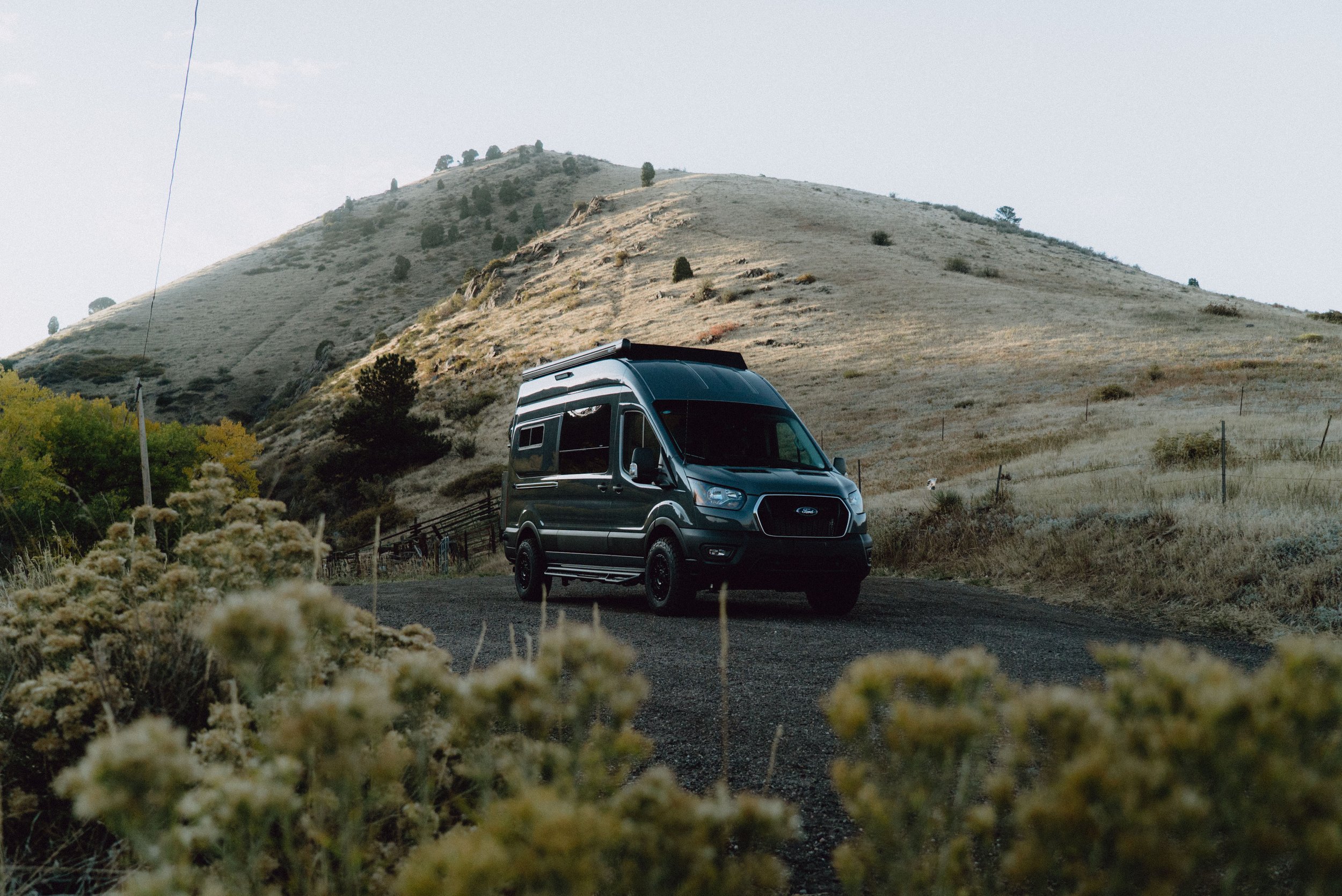
Who is Colorado Adventure Vans?
Based in the gateway of the Rockies, Colorado Adventure Vans (CAV) is an industry-leading van conversion specialist and resource hub dedicated to the pursuit of off-grid freedom.
Our community is dedicated to high-performance adventure vans deeply rooted in the idea that a reliable rig starts with thoughtful engineering, which is why we provide the same professional-grade design guidance, build notes, and field-tested gear lists that we build into our vans.
QUICK LINKS:
Where do I start? ➜
2026 Battery Guide ➜
Colorado Road Trips ➜
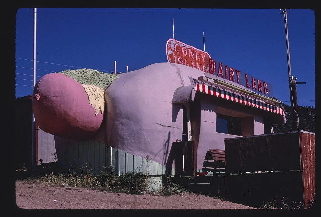
source: John Margolies Library of Congress
Day 1: Golden → Bailey → Mount Princeton Hot Springs➜
Mileage: ~130 miles | Drive time: ~2.5 hours (not counting the hot dog stop)
Pack the car the night before, get out early, and head south out of Golden on US-285. You'll climb into the foothills through Conifer and Aspen Park, and somewhere around Bailey — tucked just off the highway along the South Platte River — you'll see something that might make you do a double-take.
Stop 1: Coney Island Boardwalk, Bailey➜
Pull over. That giant hot dog you just spotted is real, and it's been a Colorado roadside institution since 1966. The building originated on West Colfax Avenue in Denver before making its slow migration out to the mountains over the decades, and has been called "the best example of roadside architecture in the state." It even earned a cameo in South Park.
The stand serves a small menu of classic frankfurters and sausages using all local Colorado suppliers — Continental Sausage, Elevation Ketchup, Merf's Mustard, Rocky Mountain Soda Company. Grab a picnic table along the river, order one of the gourmet dogs, get a shake. This isn't the destination — it's the mood setter.
Hours are limited (typically weekends, midday). Check ahead before you go.
Continue southwest on 285 through Fairplay and South Park — yes, that South Park — and down into the Arkansas River valley. The road opens into a wide, sweeping basin ringed by the Collegiate Peaks. If you've never driven this stretch before, prepare to pull over more than once just to stand in a field and look around.
Afternoon: Mount Princeton Hot Springs➜
After a presumably long trek to get here, the logical next move is soaking at Mount Princeton Hot Springs—positioned perfectly at the base of 14,197-foot Mount Princeton, with pools along Chalk Creek at varying temperatures. This is also a great place to wind down after your travel to the mountains before a full week in the high country. Mineral water, cold creek water, big peaks overhead.
Book your soak time in advance, especially on summer weekends. Then head into Buena Vista for dinner—a laid-back, outdoorsy town with a surprisingly strong food and beer scene. Eddyline Brewing ➜ is a family friendly joint that can fuel the week ahead.
Camping options near Buena Vista➜
Day 2: Twin Lakes — Hike
+ Afternoon Lake Day
Base: Twin Lakes / Buena Vista area
Morning Hike: South Elbert Trailhead ➜
The trailhead on the north side of Twin Lakes begins winding through a massive, cathedral-like aspen grove before opening up into high alpine terrain with sweeping views of the valley below.
This trailhead also leads to the summit of Mount Elbert, Colorado's highest peak at 14,439 feet. You don't have to go to the top to have an exceptional day: the first 3–5 miles of the south approach offer as much scenery as most hikes in the state, at a pace that works for a range of abilities. But if your group has the legs and the weather is cooperating, the option is right there.
The gradual elevation profile in the aspen section is manageable for most active families. Go as far as feels right, then turn around and let the lake be your cooldown.
Start early. Afternoon thunderstorms above treeline are a genuine concern.
14ers.com offers the most reliable & up-to-date trail conditions.
Camp: Twin Lakes ➜
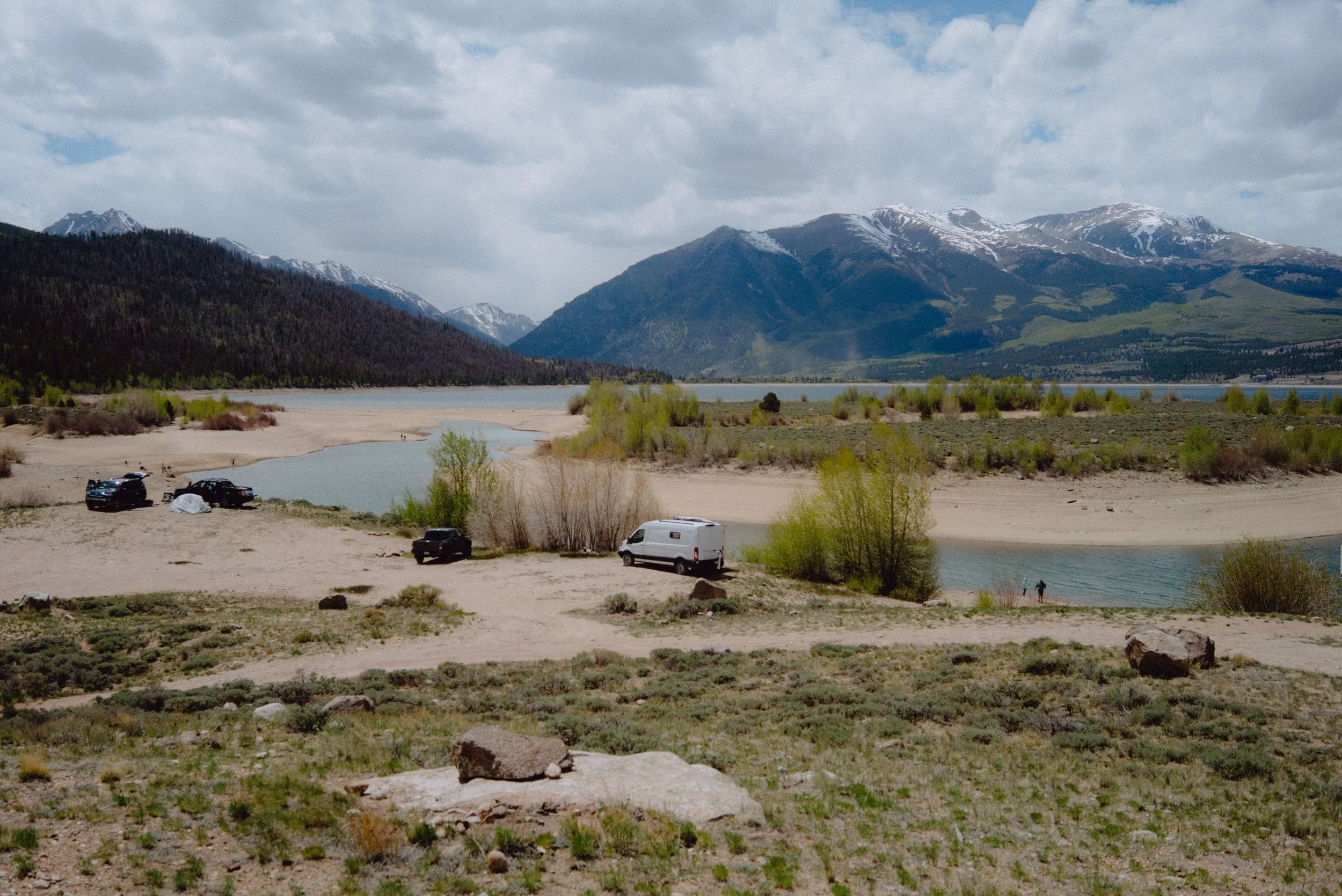
Tucked beneath the twin summits of Mount Elbert and Rinker Peak, Twin Lakes is one of those places that stops you mid-sentence. Two glacial lakes, a historic mining-era village, and a shoreline that catches the alpenglow in a way that feels almost unfair.
Camp right along the lake or in the trees just above it—either way, you're waking up to one of the best views in the state. If you brought a paddleboard, this is the spot to wind down the evening. The water is calmest on the west side in the late afternoon. The peaks are right there, and there's genuinely nowhere better to be.
Day 3: Independence Pass → Aspen → Glenwood Springs ➜
Check Independence Pass Status ➜
Mileage: ~120 miles | Drive time: ~3 hours including stops
Over Independence Pass
From Twin Lakes, head west on County Road 306 up and over Independence Pass — a 12,126-foot crossing on a paved road that feels anything but ordinary. Above treeline, the road unspools across open tundra with 360-degree views of the Sawatch and Elk ranges. Pull over at the top. Breathe the thin air. Let the kids run around.
Breakfast at a Pullout
Pack something from the night before or grab it at twin lakes general store ➜ before you leave. Somewhere on the climb, find a pullout, spread a blanket, and eat breakfast with one of the better views in Colorado.
Aspen: Lunch + River Time
The descent from Independence Pass drops you into the Roaring Fork Valley and, eventually, Aspen. Park the car and enjoy the dense pine forest.
In the summer, Aspen is a different animal than its ski-season self — more relaxed, more accessible, and botanically beautiful. The Roaring Fork River runs right through town, and the paved trail along its banks is perfect after a morning of driving and high altitude. Find a grassy spot along the bank and read a book or make a coffee. Watch one of the most expensive towns in the world go by at walking pace.
For lunch, the Hyman Ave pedestrian mall ➜ has everything from casual to special-occasion — aim somewhere in the middle and walk it off with a gelato.
Optional detour: Maroon Bells
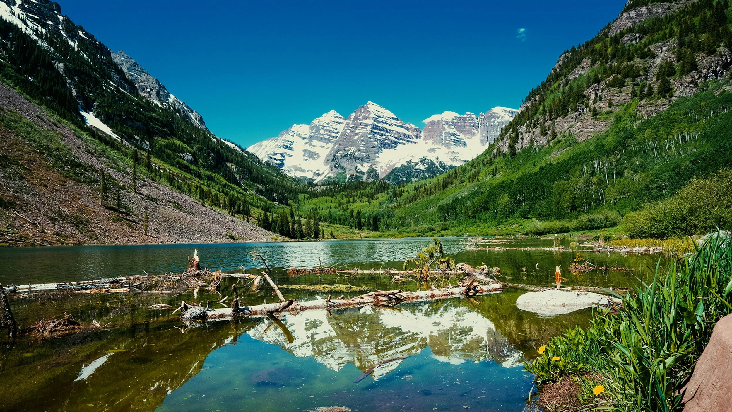
Sixteen miles south of Aspen, the Maroon Bells are arguably Colorado's most iconic vista — two 14,000-foot peaks reflected in Maroon Lake, surrounded by aspen and wildflowers in summer. It earns every superlative thrown at it. In peak season, access is by shuttle only from Aspen Highlands ➜ plan accordingly if you want to add this one.
Evening: Glenwood Springs
Head north on Highway 82 toward Glenwood Springs, arriving with enough daylight to walk the town, grab dinner on the riverfront, and settle in. For lodging, treat your group to a shower at the Hotel Colorado ➜ — a grand Victorian resort open since 1893, right downtown. Or camp at one of several campgrounds ➜ in the area if you'd rather wake up in the trees. The Hideout at Glenwood springs ➜ comes highly recommended by John from CO Adventure Vans as a great place to crash for a night.
Day 4: Glenwood Canyon → Vail Pass → Lake Dillon → Winter Park ➜
Mileage: ~130 miles | Drive time: ~3 hours
Glenwood Canyon
Start your morning by leaving Glenwood heading east on I-70 and let the canyon set the pace. The highway follows the Colorado River through 1,000-foot walls of Precambrian granite, passing hanging fern gardens and waterfalls that appear straight out of the cliff face. If something catches your eye, pull into a rest area or overlook.
Hanging lake is one of Colorado’s most intriguing stops, just a short drive from glenwood springs ➜
Vail Pass
East of the canyon, the highway climbs through Eagle and into the Vail Valley. If the family's never seen Vail Village in summer — flower boxes on every balcony, the creek running fast through the center of town — it's worth 20 minutes on foot. Continue up and over Vail Pass (10,666 feet). The summit rest area has clean facilities and big views. Step outside, appreciate that you've been above 10,000 feet approximately six times on this trip, and keep going.
Watersports Day: Lake Dillon
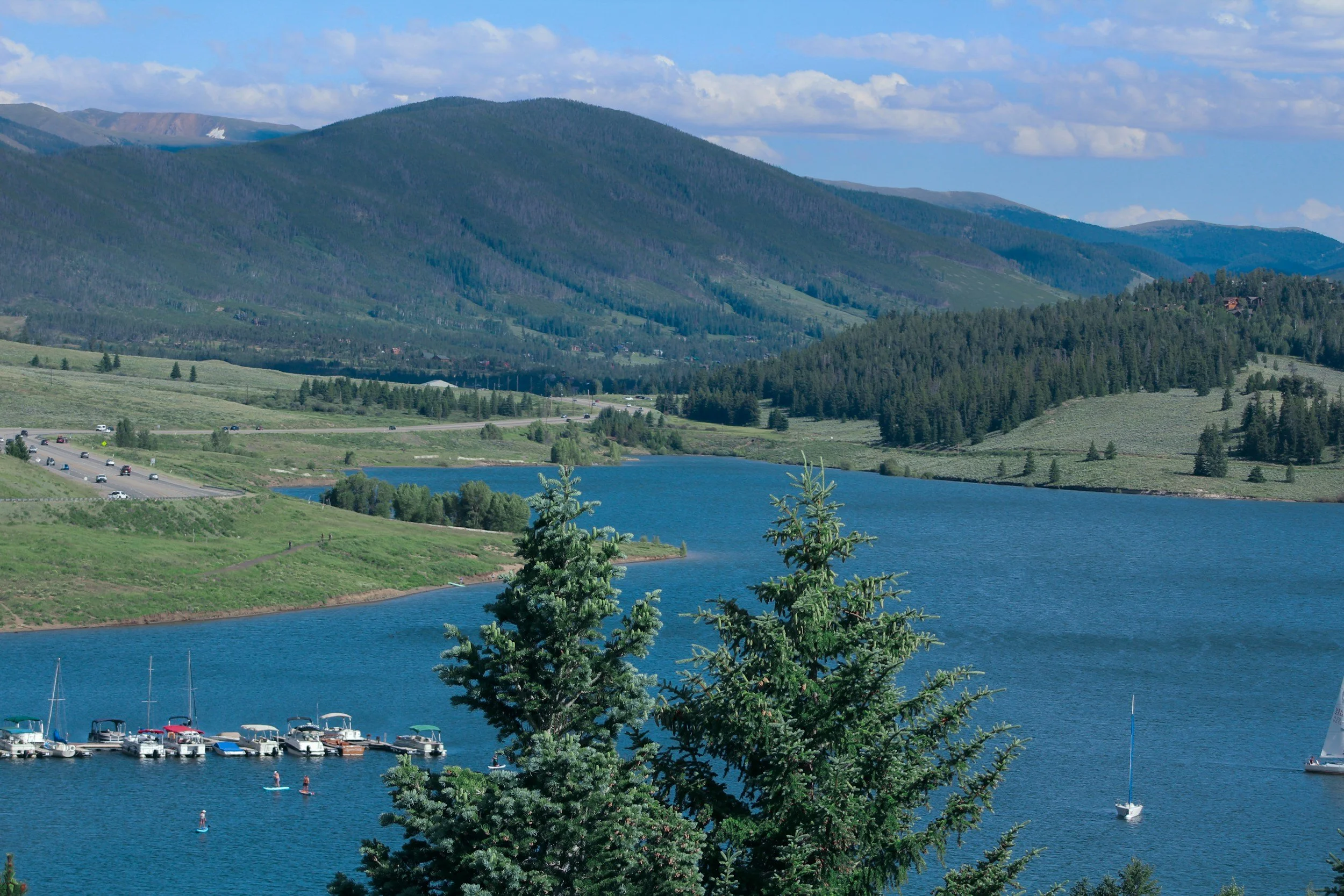
Drop into Summit County. At 9,017 feet above sea level, Dillon Reservoir is one of the highest large lakes in the country, and on a calm summer afternoon—with the Tenmile Range, Gore Range, and Williams Fork Mountains circling the water in every direction—it's as close to a perfect lake day as Colorado gets.
Both the Dillon Marina and the Frisco Bay Marina have full rental fleets: kayaks, canoes, stand-up paddleboards, pedal kayaks, pontoon boats. The Frisco side of the reservoir has numerous islands and coves that shelter from afternoon winds—ideal for families and beginners. Guided kayak tours also depart from Frisco Bay daily if you'd rather have instruction built in.
Note: Swimming is not permitted in Dillon Reservoir, but that just means you stay in the boat.
Drive to Winter Park
In the late afternoon, continue north on US-40 over Berthoud Pass (11,307 feet) and drop into Winter Park. Set up camp along the Fraser River — Idlewild ➜ and Robber's Roost ➜ campgrounds both sit in dense lodgepole pine with easy access north to Grand Lake and the west entrance of RMNP.
Days 5–7: Rocky Mountain
National Park ➜ + Estes Park
Base: Winter Park → Grand Lake → Estes Park
The West Side of RMNP
Most people enter Rocky Mountain National Park from Estes Park, the east half of the park. On the west side — accessed through Grand Lake, about 35 minutes north of Winter Park — is quieter and every bit as spectacular. This is where you can linger for the next day or two.
Timber Lake Trail ➜ is the west side's signature moderate-to-challenging hike. The 9.6-mile out-and-back gains about 2,100 feet through dense spruce-fir forest before breaking into open alpine terrain at a gorgeous cirque lake. Plan 5–6 hours.
Adams Falls ➜ is the easy counterpoint — a 0.9-mile walk from the East Inlet Trailhead near Grand Lake. Shaded, dramatic, and perfect for a morning warm-up or for the members of your group who need a shorter day.
Holzwarth Historic Site ➜ is a short flat walk to a preserved 1920s dude ranch — worth a detour if you have curious kids.
Spend a morning on Grand Lake itself, which has kayak and canoe rentals right on the water, before making your way over Trail Ridge Road.
Trail Ridge Road ➜
The drive east over Trail Ridge Road is the capstone of the whole trip — the highest continuous paved road in the United States, topping out above 12,183 feet on a stretch that runs entirely above treeline.
Estes Park: One Good Meal
Descend into Estes Park. The town gets a bad rap for being touristy—and sure, the elk-themed gift shops are real—but when you're hungry after a week in the mountains, it genuinely delivers.
Smokin' Dave's BBQ & Tap House ➜ is the call if you want smoked brisket and cold beer after six days on the road. Bird & Jim ➜ is the elevated option—locally sourced, creative menu. Walk through downtown, let the kids find something ridiculous to buy, and watch the elk graze in the meadow along the river.
Then head south on US-34 or US-36 through Lyons and Boulder, back to Golden. The mountains will be in your rearview mirror, but you’ll see them differently now.
The Loop at a Glance
1 —Golden → Bailey → Twin Lakes
Coney Island hot dogs, camp at the lake, sunset paddleboard
2 —Twin Lakes base
North Elbert Trailhead hike, Mount Princeton soak
3 —Buena Vista → Cottonwood Pass → Aspen → Glenwood Springs
The pass, Maroon Bells optional, river lunch, evening in Glenwood
4 —Glenwood Canyon → Vail Pass → Lake Dillon → Winter Park
Canyon drive, watersports, camp along the Fraser
5–7 —West RMNP → Trail Ridge Road → Estes Park → Golden
Best hiking in the park, the highest paved road in America, a great meal
Before You Go
Altitude: You'll spend most of this trip above 8,000 feet. Hydrate more than you think you need to, take it easy the first day or two, and watch kids and pets for signs of altitude sickness.
Weather: Colorado afternoon thunderstorms develop fast above treeline. Start hikes early, be off exposed ridges by noon, and always carry a rain layer even on a bluebird morning.
Book ahead: Mount Princeton Hot Springs, your RMNP timed-entry permit, and campgrounds all sell out well in advance in summer — especially on weekends.
Gas and cell service: Fill up in Buena Vista before Cottonwood Pass. Expect gaps in service in Glenwood Canyon and on mountain passes throughout.
This loop runs roughly 600 miles total. It's not a sprint, and it's not supposed to be. It's a Colorado road trip done the right way — with room to stop whenever something catches your eye. Something always will.


Follow us on Social
Check us out on social media, too, & make sure to leave a comment every now and then, it helps us reach the right people.